
| Postcode West | |
|
|

|
|
A cold shower, a colder reception ...
I was awake by ten-past seven, mainly due to the persistent but not unpleasant noise of the river and the local wildlife, including songbirds in full voice. I went to the holiday home and endured a fresh and sustained vocal attack from the caged dogs, which pretty much lasted for my whole time around the property. Why they were restrained in such a way, I never found out. I attempted to have a hot shower. I say attempted, because the place didn’t actually have any hot water, so that I was forced to have a scrotum-crawling cold shower and an equally uncomfortable and cheerless shave. The place itself was very nice and quite posh. It just wasn’t geared up for home comforts, as it was still being furnished and wasn’t officially open for business. Chilly ablutions completed, I made my way back to the river to de-camp. It always takes a fair while to pack away all my gear; my sleeping bag, bed mat and tent, as well as sorting out spare clothes, having a bite to eat and arranging which maps I’ll need for the day. It was about ten-past nine when I walked back to the holiday home to collect my electrical equipment. I could hear the lady from last night moving around inside the place and discovered my equipment and charging cables and leads, which had been dumped in an untidy bundle on the doorstep. Something about their abandoned attitude spoke of having being discovered with displeasure and this was confirmed, when the lady appeared in the doorway with severely pursed lips and a frigid set to her shoulders.
“There’s your stuff. I had to move them, as I wanted to mop my floors.”
Oops – that had definitely been delivered in a clipped manner. I presume that she thought it a cheek that I had used her electricity to charge my camera, phone and camcorder batteries. This had never previously been a problem on my travels, but fair enough. I attempted to smooth things over with some comment or other on the weather and how it looked for walking, which fell rather flat. Actually, I felt about as popular as a floating turd in a punchbowl.
“I must get on. I have to mop my floors,” She repeated and that was that.
Neither a smooth path, nor a visible one ...
Leaving her to ‘her floors’ I picked up my strewn gear and hauled on my rucksack, then walked off up the lane in some morning sunshine. I had to go back up the hill and into Grosmont once more and it was a stiff haul in the growing warmth of the day. As it happened I came across shouting, swearing man (this time silent) and his dog again before leaving the village behind, as I reached the top of Cupid’s Hill for a second time. One thing I did immediately notice was how hilly the land around me now was in all directions. I suppose it was as a result of nearing the Black Mountains but, whichever route I took today, I was in for some hard walking. I felt okay at this stage, a couple of hotspots on my feet and shoulders that were bloody sore, but otherwise in good fettle. I got back on route just as clouds started to gather. From an initial promising start, the weather deteriorated and the day turned out to be a showery one and definitely poorer than the day before. It was a day of putting my raincoat on and off.
I walked along the lane, at the top of what was one of many valley peaks in the area. Despite the clouds, the sun was trying to break through and it played upon Hatterrall Ridge. I had a splendid view of it for about twenty minutes as I clumped along, musing that I was meant to be up and over it by lunchtime and thinking that this looked a pretty tall order from where I was now. I left the lane and headed across country near Llech Wood, going down into one of many mini-valleys and losing my route on the way. It was simply a case of it becoming invisible again, as I strayed neither left nor right. I skirted Llech Farm and a copse, then sharply descended a hill which took me to a further belt of trees and something I hadn’t bargained for but wasn’t surprised to see; a man-made barrier. This one was wooden fencing topped with the obligatory barbed-wire.
 |
|
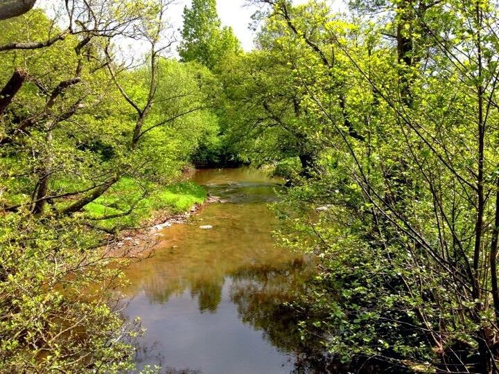
Railway track near Llangua |
A wide field took me to the crossing of a railway line not far from Llangua. I was back on-route once more, but this was not to last and my way forward became unclear near a place called Little Sunnybank. It was a choice of either climbing another steep hill towards Bridgemoor Farm, or staying low and crossing fields that seemed to contain more barbed-wire barricades than Flanders circa 1915. I made an abortive attempt uphill but I felt like I was going in the wrong direction. I retreated and next attempted to avoid the fields by walking along the edge of yet another strip of woodland. This defeated me by becoming both boggy and overgrown with reeds and long grasses. I fell back to my original position, looked at those fields grimly and then set out. I first had to cross a brook, which wasn’t a problem since it was so narrow I just found a suitable place and jumped across. I then walked the fields and reached each fence in turn. In actual fact, they didn’t turn out to be very formidable obstacles and were easily climbed or, more obligingly, came provided with gates I could get through. The problem was that they were so exposed to view and I wasn’t sure if I was trespassing on private land or not. The dwelling of Bridgemoor Farm was very prominent and I could almost feel unseen eyes piercing me. As it happened, the fences shepherded me towards the farmhouse, forcing me to climb steeply at the same time. Very steeply, as my friend back at The Bridge Inn would have emphasised, unnecessarily. Once at the top of one of these fields, I recognised a large pond from my map and after a rest to slow my breathing, I walked on. There didn’t seem to be any reason why I shouldn’t be able to follow my route from here, except that I simply couldn’t find it. I could see where it went on my OS map, but there wasn’t an actual physical path for me to walk. I spent a while crashing through another piece of woodland, the path of which delved deeper and deeper into undergrowth until it was strangled out of existence, forcing me to retrace my footsteps with a snapping of dry branches and a squelching of boggy ground. If nothing else, my walking boots proved to be extremely waterproof; a terrific improvement from my walk south eighteen months back. I continued to make hesitant forays in several directions, before plunging uphill again with Bridgemoor Farm on my right. This looked correct in accordance with my map, but in fact I had just committed a mistake which was to cost me miles and about an hour and a half of walking in the wrong direction.
A horrible dunking ...
This became apparent fairly quickly, when the landscape around me began to bear little resemblance to where I thought I was on my map. A particularly difficult climb uphill meant that I had to sit on a concrete water trough for a while, slipping off my pack and eating some of my fruit and nuts as I rested. The sun had chosen this moment to beat down again and sweat was dripping off me. This was about halfway up the incline and I needed the break before I could muster the strength to tackle the rest of it. Once up, gasping again, I struck out over another field which led me back down and towards another farm. The only farm in the vicinity on my map was Sunnybank Farm and I was dismayed at how far south from my route I had drifted. I studied the map and surmised that the only thing I could do now was follow a series of permissive paths in a large clockwise sweep, until it brought me back on route at a B-road some miles away. And this was assuming that those permissive paths were navigable. Or even still in existence. I started down to the farm on increasingly muddy ground which soon turned boggy, forcing me to jump from one mound of clogged earth to another. As I neared the farm gate, a stream of water ran by or lay in stinking pools and it became obvious that not all of the boggy bits were simply mud. A lot of cows had defecated there. It took me a careful while to navigate across what I hoped were stable clumps of grass until I reached the gate.
 |
|
Sugarloaf Mountain to the south |

The wrong way to geese and horses ...
I walked through the farmyard and used their track to journey on, realising with a futile wave of dismay that I was being taken south when I wanted to be going north to north-west. I was still lost and it was turning into a horrendous day’s walking. The fact that I was off-route was brought home to me with finality, when I came across the same railway line I had encountered earlier near Llangua. I was a mere two thirds of a mile south-west from this earlier meeting and heading further away from my trail with each step. I shouldn’t have been anywhere near this railway track but I followed it for a while, dubiously eyeing the hilly ground to my right as I tried to find a way north-west. I finally plucked up the resolve to tackle this and started upwards. It soon became laborious and was disheartening, because I was fairly sure that my endeavours were going to be met with one barrier or another. This soon proved to be accurate and I became boxed in by hedges. I was on the steep side of a field, tiring myself out by going back and forth as I tried to find a way through. I approached the twisted, sun-bleached carcass of a long-fallen tree but wasn’t able to utilise it to scramble over the obstacle. I eventually found a fenced corner of this particular field and climbed over it, suspecting by now that I was trespassing on somebody’s property. This deposited me into another wild-ish field with another perimeter fence. I angled across and climbed this one too. Sod it; I was already an interloper so to my mind, one more indiscretion wasn’t going to make matters any worse.
In fact, this decision was the beginning of an improvement in my fortunes. I walked down a grass bank from this fence and found myself in front of a large and impressive property of a light stone and with a Welsh slate roof. I joined a gravelled path, futilely attempting to hush a gaggle of geese that broke out into indignant honks as I walked by a pond. They followed me for a while, wings arched as they waddled after me and making such a racket, that I involuntarily winced and looked about me. I had hoped to walk along this path and out of the property without alerting anybody, but their feathered alarm system was making this a farcical notion. Rounding a bend in the path, I came upon a wide driveway on which was parked a land rover with its engine running, whilst two middle-aged gentlemen had a conversation across its bonnet. Surprisingly, I was able to scrunch noisily across the gravel towards them without either of them batting an eyelid. It was only as I reached them that they broke off and regarded me. “Excuse me, but would you mind telling me whereabouts I am?” I asked, waving my map at them.
“Well, I can tell you that you’re trespassing for a start,” said one of the men, but with no real rancour.
“Yes, I know. Sorry - I’m hoping to leave as soon as possible. Where am I?”
“This is Llancillo Hall,” answered the first man.
I looked at my map, surprised at how far south from my route I had strayed (about a mile and three quarters).
“Okay. What’s the quickest way back onto this B-road?” I showed them my map.
“There isn’t one. Where did you come from?”
So, I had to tell them that I had scrambled over their fields and climbed their fences. They were actually very charitable about this, but told me that there was no easy path back onto a main road. Just then, a young man and woman left the lintelled doorway of Llancillo Hall and joined us, regarding my shit-stained appearance curiously. I repeated my request to them and the man answered in an unmistakable South African accent that he knew a way off the property and onto a lane. He told me to follow them and he and the young lady walked off down the gravelled path. As we pulled away from the property, the young guy addressed me. “Look – I’m going to have to phone the lady of the house and tell her that you’re on the property, since you are trespassing.” I agreed that this was quite right.
“Okay,” he continued, “I’m going to direct you through a wood and I warn you, it’s very boggy and steep. Most important – when you reach the top, you’ll come across a large paddock and inside this are pedigree horses.” He broke off to look at me, “Because they are pedigrees they are skittish, you know, highly-strung, so please just walk through the paddock as quick as you can and ignore them. They WILL be curious and come towards you, but just keep walking okay?”
I agreed with frequent nods of the head, “Yep, sure and thanks for the help.”
He suddenly stopped and pointed out a track heading up through the gloomy interior of a wood, just as it began to rain again. They wished me luck and I started upwards under the dark canopy of the trees. On legs already heavy, I soon had to climb another slope which quickly made me breathless and turned the pack on my back into stone. The path became waterlogged and whole sections were little short of quagmires, so that I staggered from one side of the track to the other on a ridiculous incline to find the least wet bits. Frankly, I was knackered and out of breath by the time I had ascended the wooded hillside and saw that the trees were beginning to thin out, finally giving way to the paddock that the man had told me about. I had a gate to go through and the sound it made as I opened it brought forth a whinny of interest. Immediately, several horses came prancing over the prow of the hill and trotted alertly toward me, ears pricked. I did as I was asked and turned away from them, walking rapidly across the paddock to the far gate and muttering to them to leave me alone, I was just passing through. Whether I had too much of a lead on them or they gave up I don’t know, but I beat them to the gate and was quickly through, breathing a sigh of relief.
A long way to Longtown ...
If I’d thought that finding a helpfully aligned lane after this long slog would be a formality one look at my map put me right. I would hit a lane at Lodge Farm not too far ahead but this was no good, as it weaved its way in the wrong direction either way. Instead, I slogged tiredly across a procession of very hilly fields and over this lane, cutting down instead onto Walterstone Common where I crossed a spring trickling over bedrock and climbed again to the next rise. I walked more contorted fields, going downhill until I was able to reach a lane I could use near Great Hunthouse Farm. Here, I rested at the field’s edge and lamented the day’s events onto camcorder, standing next to a large, drying heap of manure while a Green Woodpecker laughed at me in the background. It was now two o’clock, I commented, and I wasn’t even yet in Longtown. How was I expected to haul myself over Hatterrall Ridge and Bal-Bach afterwards? The answer, I was strongly suspecting, is that I wouldn’t. The timetable was now an obsolete thing and I would re-evaluate once in Longtown. However, after a morning and afternoon of struggling across hilly contours, through woods and over springs at least I now had a firm road to walk along and I did so, skirting around the west flank of a hill I was originally meant to go over. I was still officially off-route, so I didn’t conquer Mynydd Ferddin hill, the 7492nd highest peak in the British Isles and the 983rd tallest in England, with an elevation of 323m (1060ft). To be honest, I was happy to let that challenge pass me by, figuring my miles walked whilst lost had more than made up for that elevation. I walked through a tiny hamlet called Clodock, where I stopped on a bridge to take a photograph of the River Monnow, which I was now crossing for the third time on this walk. Either it was meandering aimlessly, or I was. I finally plodded into Longtown at about ten-past three and eagerly approached the doors of The Crown Inn, a thirst turning my mouth into a Badger’s sett. The doors were ominously shut and when I pushed them, locked. The inn appeared to be closed and I was crushed. I wandered away to lean against a low wall bordering the car park. What now? Was I to tackle Hatterrall Ridge without a rest and something decent to eat? I wilted at the thought and was still morosely ruminating when a car pulled onto the tarmac and a young guy got out and asked me if I was okay, as he walked towards the pub.
“Is it open?” I asked, not daring to hope.
“Yes,” he said and welcomed me inside. I was probably carrying a smile as wide as the Mersey.
Longtown is a linear village in Herefordshire, on the eastern edge of the Black Mountains and part of the Brecon Beacons National Park. Its name lends to the fact that the settlement today is strung out along the lowland / winter road connecting Hay-on-Wye with the Abergavenny to Hereford road. As for The Crown Inn, well at this moment it was a place of beauty for me. I quickly ordered a pint of lemonade and followed this with a lager, after having also requested a steak, medium rare, from the menu. My body had begun to crave for red meat and I noticed often during the walk, that my thoughts dwelt on my next steak meal as I marched along. I never have such cravings at any other time and mostly eat white meat, so can only assume that something inside me was communicating that I needed iron as well as heaps of protein. I was happy to oblige. As I ate, I also enjoyed taking the pressure of my aching feet and it was amazing how an hour’s rest and refreshment recharged my willpower, just as much as my energy levels. I now felt ready to tackle the steep flank of Hatterrall.
Doing Hatterrall the hard way ...
It was just after four o’clock when I set out again and I was aware that the afternoon was rapidly slipping away and I needed to get on. It was frustrating, then, that I wasted valuable minutes trying to identify which road I needed to take out of Longtown. Even when I’d found it, I then wandered off across a field and a park before realising that I’d gone in the wrong direction. This wasn’t a big deal in the scheme of things, but it did keep me static for twenty minutes longer than I wanted, as I retraced my steps several times. It was with a mental harrumph! that I found my path and crossed above Olchon Brook and off over pasture again. Of course, it was now relentlessly uphill as I crept beneath the huge spread of the ridge and my new-found energy bled arterially away, leaving my legs leaden and my breath coming in gasps. I kept going for about three quarters of an hour, ascending the hilly ground across Coed Pen-rhiwiau, before I began to appreciate the view at my back and stopped to film it and have a rest. At least the rain had given over to cloud and outbreaks of sunshine. I walked on to the very foot of Hatterrall Ridge just south of Upper Turnant and turned left, heading south and trying to find a track that would take me up this sheer flank. I managed to make some progress, although it involved walking along a high-sided ditch and then scrambling up a more accessible part of it.
 |
The River Monnow from Clodock |

Closed on Tuesdays ...
I was too tired to film from the top of Hatterrall; really, I just wanted to get down to the priory and knew from experience that it was a protracted and uneven path. My feet were tender and I wasn’t relishing the descent, but I resignedly began to pick my way down over some loose stones on the track. The sweep of the valley was like an emerald cloth; it was mid-May and the verdure of the British countryside was out in all its richness. I was on a path unfamiliar to me at first, one which was turfed and gentle, buttressed by shallow banks of gorse. As I got lower down, the path steepened and joined one which I knew fairly well; a rockier one sometimes requiring me to take deep steps. As tired as I was feeling, I was wary of my less-responsive feet tripping and sending me sprawling. On this track it would hurt, and probably cause an injury severe enough to cut short my walk west. It was after seven o’clock when I reached the splendid ruins of the priory and stumbled down the steep steps of The Llanthony Priory Hotel bar (also known as The Abbey Hotel). I took my rucksack off stiffly, noticing how tender my back and shoulders were. In fact, I ached all over and my feet were throbbing again. Sweat had plastered my shirt to my back and I was aware that I didn’t smell exactly sweet. I was also hungry and bought a flapjack to go with my lemonade and glass of refreshing cider. I sat down briefly, but then remembered that I wanted to phone my brother. I wasn’t sure if I’d be able to contact him at all tomorrow from amidst The Black Mountains and wanted him to know that I was still okay and walking. The bar staff produced a phone for me and I was able to get through to my brother and fill him in with the details of the last two day’s walking. He wished me well and told me to be careful, knowing how remote the route was going to be for me tomorrow. I said I’d contact him if I could. He was already using an app to follow my progress via my iPhone, but my signal had been patchy all day and was dead on the floor of the valley. I went back to my seat and finished off my drinks as I considered the fact I still had to find somewhere to camp and put my tent up. I knew where the local camp site was, but this was becoming an increasingly unpleasant thought and once I’d rested, I decided to try my luck at a local place I knew of called the Half Moon Inn.
 |
Evening sunshine from the summit of Hatterrall Ridge |
“I am allowed a day off!” he finished.
I pointed out that I appreciated this and was sorry for disturbing him, but that there were no notices or signs to say the inn was shut on this day of the week. Maybe it was because I was tired, but I’m afraid that he seemed a little rude and as he shut the door again I wandered away, my mind already re-addressing the problem of acquiring a comfortable bed for the night and a hot shower or (even better) a long soak in a bath. The only other option was to return to the hotel and accept a pricey night’s accommodation but I needn’t have troubled my head about the cost, because on my return I was told that there were no vacancies that night. So, it was back to basics and I walked to the field close to the ruins and noticed that a young couple with a toddler had set up camp and had a fire going. He had long dreadlocks and they both looked a bit new-age. The toddler was a very cute little lass of about two years old. Feeling anti-social, I walked to the other end of the field and in the gloom, began to pitch my tent in the long grass, taking a while to find the most level spot I could without too many lumps and bumps in the turf. I was so tired by now that I barely took time to eat a few handfuls of dried fruit and nuts, before curling up inside my sleeping bag. It wasn’t long before I was asleep, but I took a few minutes to evaluate the state of my feet and body and hoped to have the strength for the hike come the morning. I knew it was going to be a long and difficult one.
For a full profile of the route (PDF format) click here
See Route on ......
|
|
|
|
 Prev
Next
Prev
Next

No comments:
Post a Comment