/* Rambling Owl addition to remove page titles from blogs */

Monday, 31 August 2015

The Wye Valley Walk - Day Two

The Wye Valley Way
By Mark Walford
Day Two

Route:Whitebrook to Symonds Yat East
Distance: 12.6m (20.4km)
Elevation: 39ft (12m) to 157ft (48m)
Climbing (ascent and descent): 876ft (267m) and 928ft (283m)

Prev      Next
See Route on ......

Whitebrook revisited ...

I didn’t feel too bad when I awoke, despite the physical exertions of the previous day. There were none of the anticipated stiff legs or sore muscles, which both surprised and delighted me as we were about to embark on another 12 miles. We were expecting a very different type of walk today – none of the gradients and tough terrain we enjoyed on Day One but rather a flattish march along the banks of the River Wye which, although I can’t speak for Colin, I’m pretty sure suited us both just fine. In fact, looking at the Wye Valley Walk as a whole, I have noticed a pattern where a day of gradients and harder terrain is usually followed by an easier flat stretch, so today was to be our Yin compared to yesterday’s Yang.
We set out mid-morning from Whitebrook on a day which, although dull and damp, didn’t forecast much in the way of rain. There’s not really a lot to Whitebrook these days, just a cluster of attractive cottages and a smart looking restaurant although in previous centuries it was quite an industrious place, famed for the quality of the paper it produced. That industry, along with its accompanying pollution, is now long gone but there are still echoes of the past, like the ruins of a paper mill we passed by on our way out of the village.

Relics of an industrial past at Whitebrook.


Guide Notes: The Whitebrook Valley.
Like almost every other tributary of the Wye between Chepstow and Ross-on-Wye, the Whitebrook Valley was once the scene of intense industrialisation. Early wireworks were turned into paper mills, making high quality paper from imported rags for bank notes and wallpaper. Whitebrook Farm on your left still demonstrates the size and importance of that industry with the remains of old walls, waterwheel pits and leats.


We reached the entrance to Tump Farm and looked up beyond the farm buildings to its high pastures where, the previous evening, we had wandered around hopelessly lost. The angry bull we had heard in the gathering twilight was silent this morning but the heady aroma of cow manure still hung in the air. The guide took us sharp left just past the farm, leaving the road we had erroneously trudged so far along yesterday which, we now realised, meant that we were never meant to walk in that direction at all. We had taken two wrong turns in the space of five minutes.


Redbrook – rain stopped play ...

Today (at least in theory) we shouldn’t have so many opportunities to lose the route - the river was to be our compass, and as long as we followed it in the right direction we would arrive at Symonds Yat on time and with no extra mileage added.
We joined the river to follow a broad green track that used to be the Wye Valley Railway line and as such was a flat, straight piece of walking, offering us views of the opposite bank where sheep grazed in meadows and forested hillsides rose up into the leaden skies. Apart from a couple of locals walking their dogs we ambled along in solitude, casting regular glances at the silently gliding Wye and stopping at one point to admire a carved wooden sculpture of a brace of Salmon that had been sited (or discarded - it was hard to tell) beneath the straggly cover of a hedgerow.

Guide Notes: The Wye Valley Railway.
The Wye Valley Railway closed in 1959 after 83 years of carrying passengers between Monmouth and Chepstow. The opening of the railway in 1876 quickly brought an end to the former mainstay of transport up and down the valley – riverboats and trows.

We reached our first bridge of the day, Redbrook Bridge (yet another ex-railway structure) and an old building that seemed to be suffering an identity crisis as it tried to function as a post office, a pub, a café, and a B&B. The river here formed a natural border between England and Wales and we crossed the bridge from the Welsh side into England and the riverside village of Redbrook.

On the banks of the Wye.

The rain started falling gently as soon as we set foot on English soil.
We knew Redbrook from our Offa’s Dyke walk and in fact the place where we were to get our passports stamped happened to be the place where we had enjoyed a couple of evening meals. The Bell Inn was open for business so we presented our passports to be stamped and then enjoyed a swift ale, hoping for the rain to pass. There was free wi-fi to be had, so we both sent a flurry of Tweets and Emails before shouldering our rucksacks and setting off again. The rain hadn’t stopped but had at least reduced to a fine drizzle and we made our way across the large village green that hugged the riverbank. A number of marquees and stalls had been set up on it, along with a bouncy castle. It was a bank holiday and it looked as if the villagers had organised a fete. It was rather a shame that the rain seemed to have put a dampener on the event as there were few people present and it had the air of failure about it. We sat at a bench to eat our lunch, surrounded by sagging stalls and a scattering of folk swathed in raincoats who wandered from tent to tent exchanging greetings with the stallholders. A few children ran about, jumping into puddles or squelching around on the bouncy castle. It was all a bit dejected really.

Guide Notes: Redbrook.
The name ‘Red Brook’ originated from the colour of the tributary which passes through natural iron ore deposits. Redbrook is now a quiet little village, but at one time this was also a heavily industrialised area, with a copperworks dating from the late 17th century, later converted to an ironworks and then a tinplate works. The Redbrook Tinplate Company was world famous for its high quality product and did not close until 1962.


Upstream to Monmouth ...

We left Redbrook behind, hugging the English side of the river to cross a long series of meadows. They were for the most part featureless except for one sizeable meadow that played host to a number of large marquees. This was ground that belonged to the Monmouthshire Show Society where agricultural events took place on a regular basis. It was deserted today and as we passed by I dodged into one of the large marquees to answer an urgent call of nature (apologies to the MSS). After the meadows the path became enclosed in scrubby woodland and began to undulant with our old friends the slippery tree-roots making a comeback. We had walked these tracks before, albeit in the opposite direction, on a walk to the Kymin several years before and we passed by the remains of the two railway bridges that had impressed us at that time, Firstly the sandstone buttresses and archways of the

Approaching Redbrook via the old iron railway bridge.

Wye Valley Railway Monmouth Viaduct (1861-1964) the section that spanned the river long since removed, and then the rusting iron framework of the Duke of Beaufort Bridge (1874-1964), intact and still used as a footpath and cycleway. We knew from these markers that Monmouth was now close and very soon we had reached the Wye Bridge on the edge of the town, a substantial old bridge that carried traffic on the A4136 into the town centre. The river Wye widens at this point, its waters gliding swiftly on a strong undercurrent. Canoeists emerged from under the bridge at regular intervals having set off from the Monmouth Canoeing Centre just a few hundred yards upstream. Standing on the bridge we could crane our necks and make out the tiny white shape of the naval temple and the Kymin viewpoint, set atop a high and densely wooded hill where extensive views across into Wales could be had on a fine day. We had enjoyed such a view on our Offa’s Dyke adventure before climbing down to wander through Monmouth, however today our route took us back along the riverbank without ever entering the pretty old town.

Guide Notes: Monmouth.
Monmouth’s history stretches back to pre-Roman times; ongoing archaeological excavations have revealed multiple layers of occupation. The Romans called it Bestium and established a fort; the Normans built a castle where the future King Henry V was born, which later featured in the English Civil War. There is a unique medieval gated bridge over the River Monnow, and the trial of the Chartist leaders captured after the abortive Chartists’ Rising in South Wales in 1839 was held in the Shire Hall the following year. Three were found guilty of high treason and sentenced to death by hanging and quartering, the last time this sentence was given in Britain. Fortunately, it was changed to deportation for life to Van Diemen’s Land (Tasmania). The Nelson Museum in Priory Street houses a large collection of Admiral Horatio Nelson’s love letters and gifts to his mistress Lady Emma Hamilton as well as much information on the history of Monmouth and the surrounding area. Nelson’s only other connection with Monmouth was a visit in 1802 to the Naval Temple and the Roundhouse, the whitewashed building on the summit of the 250m-high Kymin overlooking the town. It is also the home of Charles Stuart Rolls, an early pioneer of aviation and the co-founder of the Rolls Royce Company, who has the rather dubious ‘honour’ of being the first Briton to die in an air crash. The town is well supplied with visitor information in the Shire Hall, accommodation of all types, restaurants and cafés, shops, a bus station, banks and ATMs, doctors, dentists and religious centres of most denominations all within a compact area.

Just past Monmouth the hub of all the canoeing activity was reached, the Monmouth Canoe Hire and Activity Centre which is a bit of a mouthful even if you reduce it to an acronym. The MCHAC was certainly doing a brisk trade, with a large party of life-jacketed canoeists about to launch and

The remains of the Wye Valley Railway Monmouth Viaduct

another big group arriving via mini-bus.
We passed what remains of the old Monmouth Quay and continued along the riverside path and into the grounds of the pretty whitewashed church of St. Peters at Dixton. It is built perilously close to the Wye, which is a river that often bursts its banks in spectacular style, so it must have survived regular flooding over the centuries. Beyond the church were more pastures and we crossed a wooden bridge over the Mally Brook, which joined the Wye at this point. There was, according to the guidebook, a nature reserve of some sort away to our left but the route never took us through it. Instead we walked along the embankment as the steady roar of the A40, running parallel to our course, became a muted swish that gradually faded to silence as the road and the river finally parted ways, with the road continuing Northwards and the river, and therefore ourselves, swinging to the East.

Guide Notes: St Peter's Church.
At one time a ferry crossed the river at this point, and the metal gates and steps leading down to the river’s edge are the only reminders that the vicar used to regularly cross the river from the vicarage on the opposite bank. St Peter’s Church serves the parish north of Monmouth, and although in Wales is in the Church of England diocese of Hereford. The site was probably early Christian; the present church dates from the 12th century, but inside there is masonry which indicates it may have been Saxon. This little church is in active use despite regular inundations from the River Wye, indicated by brass height markers.


Hornets and hounds ...

Very soon we were back into woodland and Gnarly Bits which began to tire our feet, however compared to yesterday the day was very easy-going, with no directionally-challenged detours and very little to do but follow the river as it wound its way along, crossing the border of England and Wales capriciously and providing a series of lovely views. It was all rather splendid. We reached a point several meters above the river where the lush embankment opened up and a little concrete platform with an iron railing served as a sort of viewpoint. Below us a man was fly-fishing, probably for the famous salmon we saw on every way-marker. Its a skill we’ve always admired so we stopped for a moment to watch him. He was standing waist-deep in the water and flicked his rod back and forth with studied ease, landing his fly skilfully so that it seemed to dance on the water.

St. Peter's Church, Dixton.

I glanced at Colin and was about to offer a word or two on the fisherman’s performance but noticed instead, with some alarm, that a cloud of hornets were swirling about his head. He noticed them at the same time and with a squawk of alarm set off along the path. I followed him, ducking my head as I passed through the swarm, fearing that more might be on the way. Where they came from we'll never know. Ten paces further on a dog with a horrible rusty bark bellowed at us from behind an unseen boundary. Already on edge from the hornets this sudden noise nearly pitched us into the river and I'm pretty sure the fisherman heard us both shout the same expletive in loud unison.
This little drama aside, we continued along some very pretty woodland in peaceful solitude. Here and there we came across evidence of times past, when this land was under private ownership (I believe that there used to be a deer park in the vicinity). An old stone wall, broken away at the path, with an ancient wooden door opening onto nothing but a wild glade, and the remains of an iron fence, complete with a gate permanently locked, which the forest trail swerved around almost contemptuously. After the woodland we broke out into a wide meadow once more. This actually was still private land and a notice pointed this out politely, telling us to stick to the riverside path. The property to which this land belonged, Wyastone Leys, was perched slightly on a rise to our left. It was a fine old country house and it watched us pass by from its many windows.

Guide Notes: Wyastone Leys.
Wyastone Leys was originally built in 1795 and rebuilt in the 1830s by industrialist Richard Blakemore. He extended the estate to include the Little Doward hillfort behind enhancing it with landscaped viewpoints, an iron tower folly, carriage drives and a walled deer park. A later owner extended the house further in 1860–61 by the Scottish architect, William Burns. A small herd of fallow deer are still kept in a reserve on the edge of the Little Doward. Since the early 1970s the Wyastone Estate has been the home of Nimbus Records, one of the pioneers of Compact Disc manufacturing and recording. They built a concert hall for recordings, and concerts open to the public are held occasionally featuring top classical and jazz musicians.

Beyond the estate it was woodland walking again, a place of dark hollows where colonies of Hearts Tongue Fern grew in abundance and fallen tree trunks were softened by thick blankets of moss. We were in fact walking along in a part of the Forest Of Dean which sprawls across this area of England and where Colin and I had enjoyed directionally challenged moments on several occasions in the past. We came to a large cliff face in a clearing to our right, perhaps twenty meters high, and we guessed (rightly as it happens) that this was no natural phenomena but was the result of quarrying. I learned later from the guidebook that above these cliffs are King Arthurs Caves which I visited once, many years ago, with my two young daughters.

Guide Notes: The quarry.
This rock face is known as the ‘Seven Sisters Rocks’. Limestone from this rock face was shipped down stream by riverboats, for building purposes and for making lime. Above are King Arthur’s Caves; although links to the mythical king are unlikely, evidence has been found of man’s presence from 12,000 years ago, before the last ice age, along with the remains of mammoth, woolly rhinoceros and sabre tooth tiger. Today these caves are home to some of our most endangered bats, the lesser and greater horseshoe.


A bouncy bridge and a long last mile ...

The woodland came to an abrupt end not long after this at the Biblins Youth Campsite, and we stopped for a few minutes to sample some blackberries that were just ripening as the summer waned. It was hit and miss. Some of the fruit were sweet and juicy, others a bit like biting into a wedge of lemon. Biblins is a popular hangout and we walked to the Biblins Suspension Bridge in the company of families with inquisitive dogs and tantrum-prone children. The bridge itself has a warning that no more than twelve people at a time should cross it and so we waited patiently as a party of sixteen stamped their way across before setting off ourselves. I had crossed the bridge before (on the same day that we visited King Arthurs Caves) and I thought it had changed little in the intervening years, however this is apparently a newer version, with access ramps replacing the old wooden steps that I must have used back then. Its quite a small footbridge, suspended by thick steel hawsers across the river, and its narrow footway springs up and down noticeably as you walk along - in fact the whole structure squeaks and boings enthusiastically. I know of people who have refused to cross it, not liking all the swinging about, but the alternative (if you want to get to Symonds Yat) is a long walk upstream and a ferry crossing. As we bounced along I heard Colin savour the word 'Plummet' behind me as he mused on the several meters of air beneath us and the cold waters of the Wye lying in wait.

Mark crossing Biblins Bridge.

I would have guessed that crossing the bridge would bring us into England but in fact we crossed back into Wales to turn left upon a wide level pathway that led to Symonds Yat East. This was yet another ex-railway track, being the former Monmouth to Ross-on-Wye line, and it was busy with day-trippers since the weather had improved steadily. We came across the second wooden sculpture of the day, the Roger Withers memorial seat, placed in memory of the former Wye Valley AONB Cycle Routes Officer, and continued along the path with the Wye a few meters below us on our right. This was a very easy end to a rather gentle days walking but the previous days efforts had taken its toll and we were sore of leg by now. It was a long final mile before we finally reached the hubbub of Symonds Yat East and parked ourselves gratefully at a table overlooking the river at the Saracens Head pub. This was the third passport station of our journey and we collected our stamps as well as a couple of pints and put our feet up, watching the business of Symonds Yat East pass by. The business seemed to be either bicycle or canoe related, both of which were well catered for in this small riverside village. The ferry plied its trade, a wooden pontoon-like affair that was dragged across the river by hand using a cable stretched from bank to bank. It looked like hard work but apparently in the height of summer it can be lucrative and is a much coveted occupation.

Guide Notes: Symonds Yat East.
The river here is very popular with canoeists, the rapids being ideal for training novices. In the 17th century a weir was built here to divert water to an ironworks on the opposite bank. The New Weir ironworks were in use from at least the 1590s up until the 1800s. It had various forges, mills and hammers powered by water wheels for refining iron from nearby furnaces. The rapids are formed from the collapsed weir and slag heaps from the ironworks. The rapids have been purchased by the British Canoe Union and were remodelled in 2009. The site was surveyed in 2009 and consolidated in 2010 as part of the AONB ‘Overlooking the Wye’ scheme funded by the Heritage Lottery Fund.


Goodbye to the Wye … for now ...

And that was the end of the day. In fact as far as the Wye Valley Walk was concerned it was the end for the year. It would be Spring 2016 before we could get together again and set off on days three and four, when we would walk along the familiar meadows of Welsh Bicknor, pass by a mere stones-throw from Colin's cottage via Ross-on-Wye, visit the city of Hereford and then walk off into the uncharted territory of the welsh borders in search of Hay-on-Wye.

For a full profile of the route (PDF format) click here


See Route on ......

Prev      Next

Sunday, 30 August 2015

The Wye Valley Walk - Day One

The Wye Valley Way
By Mark Walford
Day One

Route:Chepstow to Whitebrook
Distance: 12m (19.3km)
Elevation: 23ft (7m) to 384ft (117m)
Climbing (ascent and descent): 2,415ft (736m) and 2,411ft (735m)

     Next
See Route on ......

A late start from Chepstow ...

Rain had been forecast and the skies were grey and heavy with it when we arrived at Chepstow Castle, the official starting point of the Wye Valley Walk. The really serious rain was not due until later in the morning, so we gave it every opportunity to catch us up — ensuring we would be thoroughly wet from the outset — by setting off considerably later than planned. It was to be a day of errors and omissions, both major and minor, and our first was to feed four English pounds into the parking meter only to be informed immediately afterwards by a passing local that parking was free all day on Sundays. A small irritation. We consoled ourselves that at least the car was safely placed and easily findable. A burger van had opened for business nearby, and I made a mental note of it for the return — not for the burgers, but on the question of cold water.
Our final task before finding the start was to collect a couple of Wye Valley Walk passports from the Tourist Information centre. These contained spaces for stamps collected at nominated stations along the route. Some were TICs like this one, but the majority were public houses, which gave us an excellent reason for stopping at such places. Perhaps that was the intent behind the passports anyway.
Under the crumbling walls of the

Both of us fresh and ready for the start

castle we found the large rock marking the official beginning of this hundred-and-thirty-six mile adventure and began taking the photographs that such occasions demand. Colin was framing me against the stone when a local lady approached with a pair of small dogs. She was, we concluded very quickly, hard of hearing — and, like many people in that situation, she communicated at a volume calibrated for the assumption that everyone else was too.
"SHALL I TAKE A PICTURE OF THE TWO OF YOU TOGETHER?" she announced, which bounced off the castle walls at some effect.
We agreed gratefully. Colin handed over his camera.
"I'M NOT VERY GOOD AT THIS — I USUALLY CUT PEOPLES HEADS OFF," she reported. Then: "OH THAT'S THE THING I NEED TO PRESS IS IT?"
She took a genuinely lovely photograph of the two of us. We thanked her warmly.
"NOT AT ALL," she replied, at full broadcast volume. "YOU TWO HAVE A LOVELY DAY!!"
We lingered for a while, admiring the frowning battlements of the castle that loomed above us, and shot some video, and shuffled our feet, and stared with some trepidation at the gloomy rain-clouds overhead. There was nothing for it: it was time to be off.
However, we lingered for a while, admiring Chepstow Castle from beneath — it looms over the starting rock with the particular authority of a building that has been doing exactly this since 1067, when William Fitz Osbern, a compatriot of the Conqueror, raised the first stone-built Norman castle in Britain on this commanding position above the Wye. It survived sieges during the Civil War in the 1640s before finding a second career as a state prison. The large tower directly overhead is Marten's Tower, named for Henry Marten — one of the regicides who signed the death warrant of Charles I. When Charles II restored the monarchy in 1660, Marten was lucky to avoid the fate of his fellow signatories, escaping execution only to spend, ironically, the remaining twelve years of his life imprisoned in the tower that now bears his name. I suppose there are worse ways to be commemorated.
The town itself, before the industrial expansion of Newport and Cardiff drew trade away along the Severn estuary, was an important port. The old town walls visible on the hill above us are its evidence, along with the knowledge that small flat-bottomed boats called trows once worked these waters — carrying iron and wire from Tintern and Redbrook, timber and oak bark, paper from Whitebrook, and wine inbound from Bristol and beyond. The Industrial Revolution transferred all of this elsewhere and left Chepstow to preserve itself largely intact, which, on balance, seems like a reasonable outcome.
We encountered the booming lady one final time as we made our way through town looking for the high street — she provided detailed directions at full volume, startling passers-by — and then parted from her for the last time with waves and smiles.
"GOODBYE MY LOVELIES — ENJOY YOUR WALK!"
Colin had, it then emerged, forgotten to pack a waterproof coat. We found an outlet on the high street almost immediately, which was the easy part. His chosen coat had no price label, which required two confused shop assistants, a monitor, a keyboard, and twenty minutes of increasingly improvised investigation to resolve. I lost interest in the proceedings and wandered to a nearby Greggs for packed lunches. The coat was eventually sold at a price reached by mutual agreement through the time-honoured method of haggling, and we made our way back to the castle to begin in earnest. It was, by now, raining persistently.


Pretty viewpoints, pretty damp ...

We had mapped the day's profile as part of our planning and knew there would be over two thousand feet of climbing. This began immediately — the path rising to a road, the road rising through the suburbs of Chepstow, the whole enterprise heading firmly upward from the first step. This is worth saying clearly about the Wye Valley Walk: it is not a stroll along a riverbank. For geographical reasons and the realities of land ownership, the path is often drawn away from the river and forced onto the wooded hillsides above the gorge. Some of those hillsides are steep and some of those climbs are long, and while the profile promised as much descent as ascent, it never quite felt that way in practice. What this approach offers in return is a route of genuine variety — dense forest, open pasture, cider orchards, meadows, and moorland — and views of the Wye Valley in its full depth rather than just its river floor. If you walk this route, be prepared for real hiking.
We left the road and Chepstow behind via school grounds, picking up a forest path where the tree canopy absorbed most of the rain and we were at least able to lower our hoods and look about us. The path entered Piercefield Park, private land but open to walkers, where a series of viewpoints

Chepstow Castle

had been laid out in the 1750s by Valentine Morris, the park's then owner, whose West Indian estates provided the wealth for such enterprises. The walks and viewpoints became a celebrated attraction on what was known as the Wye Tour — visitors arriving by boat and carriage from across Britain to see the spectacular gorge, in a way that made this corner of Monmouthshire one of the birthplaces of organised tourism. The viewpoints were originally designed to be walked south to north, rearranged by a later owner in 1790, and added to in the early nineteenth century by Nathaniel Wells — the son of a plantation owner and an enslaved woman, who inherited his father's estates and became the first Black High Sheriff in Britain.
We met a retired couple on the trail, and a younger couple with a dog who appeared to be attempting the same stretch, and for some time we overtook each other at intervals as we stopped along the way. At the Alcove seat, a viewpoint looking back toward Chepstow, we paused. The castle was visible behind us, the town below it, and beyond both the white spans of the Second Severn Crossing. The Wye moved silently below — dun brown, the banks slick with mud, still tidal at this point. It would remain so until we reached Brockweir, and there was something odd and satisfying about that: the river we were following was still subject to the pull of the ocean, and with each mile north we walked it would become younger — swifter, clearer, less interested in tides — until eventually we would trace it back to a hillside in Wales where it was nothing but cold water pushing out of the ground.
The bypass cutting across the middle distance was, we agreed, a missed opportunity — a grey concrete flyover inserted into one of the finer river views in the country with no apparent consideration of whether anything might be done to soften it. Perhaps if it were designed today someone would at least try.
The path climbed and the footing became demanding — rocks and tree roots, everything slick with wet. Colin recognised this section: he had worked here as a conservation volunteer some years before, clearing the undergrowth and levelling the track where the terrain allowed. He pointed out the sections he and his colleagues had worked on. It looked, as I told him, like genuinely hard work.

Into the Giants Cave

He diverted left into a feature called the Grotto — a structure set into the hillside that resembled, as much as anything, a Neanderthal bus shelter, built for the Georgian visitors to shelter in and originally decorated with sea shells, long since departed. A little further on we reached the Giants Cave, a tunnel chiselled through living rock with a view down to the river far below — worth the pause, though the tunnel itself offered a strong smell of urine as its principal attraction. Valentine Morris, apparently, used to have guns fired from here so his guests could count the echoes bouncing between the cliff faces. Seven times, on a good day. A different era's entertainment.
After the cave the path narrowed and steepened, the drop to the unseen river increasingly vertical to our right. A trip in that direction would have produced an unpleasant sequence of tree trunks before a distant splash, and we moved with appropriate care. Not the ideal terrain for children or dogs in wet weather.
We broke from the trees at the Lower Wyndcliff car park where the rain reasserted itself without the shelter of the canopy and we pulled our waterproofs back on with the grumbling of people who had briefly entertained hope. Beyond the car park lay an old quarry and a choice of the 365 Steps — installed for those energetic Georgians who climbed them for views — or a track. The views from the steps would have been magnificent on a clear day. On this day they would have been cloud. We took the track, which was barely less strenuous. At the top, the Eagles Nest viewpoint — said to be a favourite of the Duke of Beaufort, which is the kind of recommendation that carries weight if you are the Duke of Beaufort. On this particular morning it offered a blank white void with the ghost of a single tree in the foreground. The guidebook's enthusiasm for the panorama was noted and filed against a future visit. If you are curious here is a link to what the view can offer on a fine day.


Abbeys, shindigs, cricket, and beer off-piste ...

We descended through Minepit Wood — where ironstone was mined (possibly by the monks of Tintern Abbey) using the *scowles* system; following ore seams close to the surface in the same way as the Forest of Dean, creating deep fissures or trenches in the ground — and then out through soggy pastures down the hillside to the first outlying cottages of Tintern.
We had both been here several times and rate it highly. The abbey ruins appear suddenly when you approach from the road — the great Gothic skeleton of the building leaping into view with a slightly theatrical effect that demands attention. Founded in 1131 by the Cistercians on land granted by Walter de Clare of Chepstow, it grew wealthy enough by the thirteenth century to build the magnificent structure of which these ruins are the bones, and the bones are considerable. The river here is no longer tidal and no longer brown — it runs wide and green and quick, the Severn's influence gone. There are good restaurants, several shops, and a pub serving a mixed grill of legendary proportions. I could go on. Go and visit.
Colin and I sat on a low stone wall between the abbey and the river and ate our packed lunches while tourists of several nationalities wandered past.

A tricky path

A French man crossed the car park wearing trousers so spectacularly baggy and vividly red that we stared openly. He carried them with the confidence of a man who is making a deliberate statement, which is probably fair — he was French and almost certainly better informed about these things than two Englishmen in shapeless walking gear.
The local wasp population descended on us almost immediately. At this time of year, with their larval food source exhausted, they are in perpetual emergency search for sugar and cannot be blamed for the persistence this produces, even if it tests the patience. After some arm-waving and cursing I compromised by depositing a small puddle of Lucozade Sport into a hollow in the brickwork, which partially redirected their attention, and we ate in relative peace.
We moved on through Tintern, along the wide flat track beside the river — welcome after the morning's gradients — and then a stretch of the main street past the pub with the mixed grill, which we regarded with some longing and kept walking.
We walked through the grounds of St. Michael’s Church to reach the riverbank once more and then, for a rare space of time, we followed its course, close enough to jump in if we were so inclined. The appearance of canoeists reminded us of just how popular this past-time is on the lower reaches of the Wye. Symonds Yat East in particular seems to be a Mecca for canoe clubs. We watched a family of four glide by, paddles flailing in an un-coordinated manner, and speculated on the perils of such an outdoor pursuit. Colin knows better than I how risky an adventure it can be, as he and his son had capsized on a canoeing trip a few years before which had cost him a phone, a camera, and a significant loss of dignity. We wondered how far up along the course of the river this activity would be evident or whether it was concentrated down here in Herefordshire, where the river is wide and relatively smooth.
A grassy meadow produced an unexpected sound: amplified country and western music, incongruous in the Welsh countryside, emanating from a wooden community building with a veranda looking over the river. Heads bobbed in unison inside. It appeared to be some kind of shindig. Colin performed a brief Irish jig for the camera, which is committed to video and may surface at inopportune moments in future.
The next meadow offered something better still. On the far bank, a village cricket match was in progress — batsmen coming and going at a rate suggesting that wickets were falling with some regularity and nobody was especially distressed about it. The umpires, inexplicably, were both wearing kilts. As I filmed, a new batsman took crease, the bowler ran in, and he was bowled first ball. The crowd cheered with the particular warmth of people who are rooting for the entertainment rather than the result, and the outgoing batsman tucked his bat under his arm and made cheerfully for the beer tent, where most of his teammates already appeared to be. The kilted umpires conferred – perhaps confirming that they had indeed run out of batsmen and could also retire themselves to the beer tent.
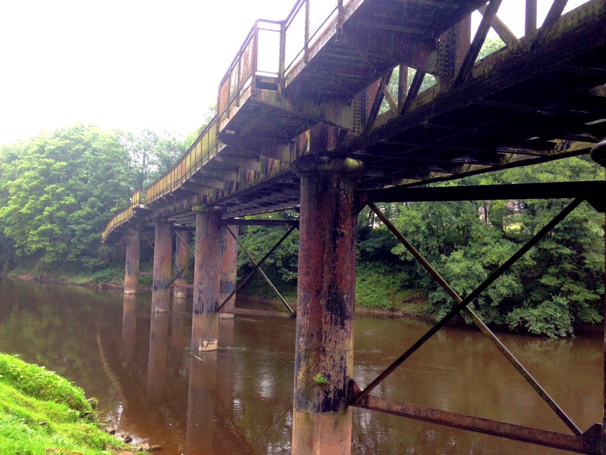
Brockweir bridge crossed next — a large iron construction carrying us over the river and into Brockweir village. Once the busiest port on the Wye, where cargoes were transferred between ocean-going ships and the trows, it is quieter now, its old quay restored and its function historical. Across the bridge, the Offa's Dyke National Trail joins from the east — territory Colin and I know well from the walk four years before.
The village pub was open and not listed as a passport stamp location, but our efforts seemed to deserve a pint of ale regardless. We sat outside in the temporary absence of rain and rested our feet for twenty minutes.
We then set off in the wrong direction for quite a long time.
The logic had seemed sound: follow the road uphill out of the village. At the top we established that the logic was not sound. We walked back down to the pub and spent some time with the guidebook, which appeared to be describing a route we couldn't reconcile with what we were standing in front of. Eventually we realised we should never have crossed the bridge at all, and Brockweir had been an entirely unnecessary detour.
Never mind. The ale was good.


Wrong turns and things we never saw ...

We crossed the bridge back and found the Wye Valley Way waymark — a leaping salmon, which would have made an excellent pub name and apparently nobody has acted on this — and began climbing again, leaving the river and its flat meadows for the forested hillsides. It was raining heavily again. A short energetic ascent levelled into an avenue of old pines and then forest tracks, eventually reaching the Whitestone Forestry Commission Picnic Site,

Tintern Abbey

where the waymarks began behaving peculiarly and sent us in circles. The guidebook instructions and the ground in front of us declined to correspond. We resorted to asking two women with dogs, who were on their way back to their cars. They knew where Whitebrook was by road but not by path, and while we discussed this one of the dogs wound itself around my leg so thoroughly that the lead wrapped me like a ribbon on a maypole. They offered us a lift to Whitebrook, which we politely declined — it would have been cheating — and pointed us toward a steep upward track between the trees that they were half-sure led in the right direction.
We unwound the dog and climbed.
At the top, a wider trail and, passing by, a man on a large horse.
"Is this the way to Whitebrook?" we asked.
"Whitebrook?" he said. "Yes."
He rode on. His horse's tail swished. We followed the direction of the tail until a T-junction with no road signs, at which point the man and his horse had vanished entirely. Left, right, or straight ahead on a smaller path — no information available, no way of knowing. We had come this far without maps or GPS on the confident assumption that a well-marked long-distance trail in Herefordshire could not really defeat two experienced walkers. This is the kind of assumption that so-called experienced walkers make, and it is always wrong.
After a quite a long time we came to a little lane that darted off to our right, with a sign that told us it led to Cleddon. We recognised that name - it was back on-route. Irritated at the time and distance this diversion had cost us we turned down the lane and walked past several very pleasant properties and into the tiny hamlet of Cleddon where it began to lash down with rain again. The guide book enthused greatly about the section of the walk we had just missed, talking about three fine viewpoints (an irony since we had seen almost nothing but trees all day) and a small but picturesque waterfall.
From here at least the Wye Valley walk was easy to pick up once more and we set off along an old railway track, its wide expanse bedecked with ferns and wild flowers. As the day waned the weather did its best to improve and after the soaking in Cleddon the rain ceased altogether, with a wan sunlight pouring through ragged breaks in the clouds. At the end of this broad track we were, finally, offered the chance of a fine view as a clearing opened to our right and we saw that a bench was perched on a high vantage point looking down along the Wye Valley. The day had become still and the wine-yellow sunlight filtered down onto the steeply wooded hillside of the valley below us. Colours were diffuse and dreamlike, painted in soft watercolours, and the gentle hills of the valley rolled away to the south, each one becoming more hazy and indistinct - seen through the fog of moisture which still hung in the air. Somewhere down in the floor of this green gorge the river Wye glided along, but it was lost to us from this height. Only the gorge itself, carved by the river over its age-long existence, provided any hint of its location. It was simply stunning and we spent a while taking it all in, regretting slightly the other viewpoints we had missed.
It was time to get moving again and we left the green track behind us, descending down steep metalled lanes through the village of Pen-y-Fan, assured by a passing farmer that Whitebrook was now very close indeed. That was something I was glad to hear. It had been a long day of many gradients and my knee was beginning to seize up, a hazard I have had to live with for several years. I didn’t think it had much more mileage in it and I was weary and a little footsore, looking forward to sitting in a warm car a with a cold beer waiting for me at Brock cottage.
We reached the gated entrance to a large whitewashed property where a sign-post directed us to the right and down a sharp and twisted little cutting between tall undergrowth. The rocks on this track were still slippery and wet and every so often a flight of crude wooden steps had been cut into the track. I have never liked these kinds of step and I have complained about them before in other journals. None of them seemed designed for a normal human leg-length and with a gammy knee I was proceeding down the track at a snail’s pace, right leg stiff and inflexible, like Herr Flick. At last we reached the bottom which dumped us out onto a small metalled lane and the beginning of our final folly.


Dumb Decisions ...

There was a finger post at the bottom of the twisty track that indicated the direction of the Wye Valley Walk. I set off in that direction, convinced that this was also where Whitebrook, and our car, waited. Colin said nothing but followed along and so we rounded a corner to pass in front of Tump Farm, with its strong smell of cow manure and the threatening rumblings of a bull which sounded both very close and very large. There was a regular wooden thumping noise which sounded as if the beast was trying to kick itself free of whatever container it had been placed in. We were glad to put the place behind us. Just beyond the farm was a field that sloped viciously away to our right, up to lofty, unseen pastures. It was a monster of a slope, covered in rugged grass.
“Bloody hell,” exclaimed Colin craning his neck, “I wouldn't want to climb that the way I'm feeling”
Prophetic words.
For quite a long time we marched along and only when it became obvious that we were heading back out into unpopulated greenbelt did we stop and consider our position. It was obvious that Whitebrook did not lie in this direction. Colin managed to get a signal for his mobile phone and opened up a map utility. He nodded as if confirming his suspicions and gave me the bad news. We should have turned left at the finger post at the bottom of the

Walking into Cleddon

track instead of right and now we had a whole lot of backtracking to complete before the walk was done. He had thought as much when we set off along the road but I had seemed so confident that he deferred to my better judgement. If he had punched me in the throat at this moment I wouldn't have blamed him.
Late in the day, facing a long backtrack along the road and the prospect of reaching the car in darkness without a head torch — another omission — Colin spotted a finger post pointing up a narrow overgrown path to the left. *Whitebrook 1¼*, it said. I was doubtful. The road at least offered certainty. Colin had already started up the path, so I followed.
The track climbed steadily into a long grassy field that continued uphill without mercy. My knee, which had been making observations for some time, upgraded to formal complaint. When the field finally levelled, we were high above the road and had, it emerged, climbed the monster slope that Colin had noted with relief was not part of our route, back when we were still on the flat and the end had seemed close.
The field ended at a scrubby meadow that fell sharply away before us. At the bottom: a thick hedgerow, a barbed wire fence, and the sound of a brook in the undergrowth. Beyond the hedge, just visible, the lane to Whitebrook. Unreachable.
Colin began hacking along the hedge looking for a gap or a gate. I turned and began climbing back up the steep grassy slope, asking my knees to do things they had formally declined to do. Two thirds of the way up I stopped, lay down on the grass, and — for the first and only time in my walking life — felt genuinely nauseous with exertion. Colin passed me going upward, his face expressing what considerable restraint prevented him from saying.
"What larks we're having," he might have offered. He didn't.
At the top we separated — I went to find the track back down to the road, Colin went further along the field to look for another way. This is another thing you should not do on a walk, and we were accumulating a considerable list by this point in the evening.

A view of the Wye Valley

I retraced my steps and could not find the open gate. I walked a wide circle and returned to the same locked five-bar gate with an electric fence attached to it. I did this three times. I was lost on top of being lost, alone on a darkening hilltop, apparently unable to locate an open gate in a field that contained only two exits.
I took stock. Two buildings were visible: Tump Farm below in the valley, with its ambient smell of manure and the distant threatening percussion of its moody bull kicking something solid — not an inviting prospect in gathering dark — and a white cottage up another slope to my left. I chose the cottage, climbed the final slope on legs that had nothing left, reached the stone boundary wall, and hauled myself over it, pulling a pectoral muscle in the process. I crawled onto the gravel of the cottage's front drive.
The cottage was empty. The owners were out. I hurried across the drive — boots announcing every step in the still air — turned right down a lane, and followed it downward. Very soon a familiar gated entrance appeared: the large whitewashed property with the signpost pointing right, down the twisted little track with the wooden steps.
I was going down it again.
It was dark in the cutting now, the thicket closing off the sky. My phone rang halfway down. Colin — his own adventure concluded successfully, a different hidden path found, already at Whitebrook. I told him where I was. By the time I limped onto the road he came around the corner in the car.
"Awright?" he said, as though he had simply collected me from a bus stop.
"Awright mate," I replied, in much the same register.


A late return to Chepstow ...

We drove back to Chepstow and the car I had parked that morning when the day was young and the possibilities were unlimited. It was full dark. The burger van was still open. I asked for cold water. They had cold lemonade, which was what they had left. It tasted like the finest lemonade ever.
I sat on the tailgate and removed my boots and socks. My feet had the pale, slightly luminous quality of dead cod. Two young women in the adjacent car found this amusing, which I registered from a considerable distance of fatigue and filed without further attention. I put on my deck shoes with the dignity I had available, which was not extensive.
We worked it out later. The diversions and unplanned excursions had added approximately six miles to what had already been a strenuous twelve-mile route, turning it into an eighteen-mile day. We had demonstrated comprehensively how ill-equipped we had been — no maps, no GPS in regular use, no head torches, no waterproof coat until the haggling was done — and we accepted this with good grace. It had been a lesson learned. Thoroughly and expensively, but learned.
Brock Cottage at nine-thirty, three hours later than scheduled. Pizza, one beer, a shower, and a sleep of the specific quality that a genuinely hard day produces.
Day one: done.

For a full profile of the route (PDF format) click here


See Route on ......

     Next

Sunday, 16 August 2015

The Millennium Way - Day Six

The Millennium Way
By Mark Walford
Day Six

Route:Packwood House to Morton Bagot
Distance: 11.5m (18.5km)
Elevation: 249ft (76m) to 499ft (152m)
Climbing (ascent and descent): 902ft (275m) and 1014ft (309m)

Prev      Next
See Route on ......

One Christmas, One Easter, and one summer holiday later ….

Almost a year since the last section, and here I was again, standing before Packwood House under a bright August morning and wondering where the time had gone. There was the winter hiatus, of course. And then in spring I had decided to dig a large hole in the garden and fill it with water — a project that consumed more of the calendar than anticipated. Family things, commitments, a holiday in Devon, and a quantity of laziness that I would rather not specify precisely. Mid-August 2015. Early summer already a memory. Autumn shuffling its feet in the wings. And not one single mile added to the Millennium Way since the previous autumn. I had started to feel genuinely guilty about this — not guilty enough, apparently, to do anything about it until now, but guilty nonetheless. I had mentioned, at some point, an intention to finish the walk by the end of the year, though I had been careful not to specify which year, which in retrospect was prudent. I had shoe-horned this Sunday in between holidays and household maintenance tasks that remained, as ever, on the list, and here I was: over-rested, under-prepared, and ready for stage six.


A big house, a small church, and a silent car ...

I stood before the wrought iron gates of Packwood House which looked very fine in the early morning light — ancient brickwork glowing orange and russet, uneven rooflines against a cloudless blue, the lawns still sparkly with dew. Two National trust volunteers were doing battle with a gazebo in the car park. I walked up and down in front of the main house, with the camera and a pleasant hour slipped by.
The house was built in the sixteenth century and its interior extensively reimagined between the wars by Graham Baron Ash — a man who accumulated salvaged objects and exotic pieces into what one visitor in the 1920s described as *a house to dream of, a garden to dream in.* It contains a fine collection of Tudor textiles and furniture, and gardens with renowned herbaceous borders and a famous stand of topiary yews. It also carries the longer history of its rivalry with Baddesley Clinton — the Protestant family of Packwood against the Catholic family of Baddesley Clinton, a game of influence and survival whose rules were set by monarchy and whose consequences I described in the Heart of England Way journal. Packwood won. They were on the right side of the Reformation, which in Tudor England was the only side worth being on.
I gave the house a final backward glance, shouldered the rucksack, and set off along the lane.

St. Giles church, Packwood

Within fifty yards I extended my walking pole and heard a sharp mechanical click. There was a STOP line engraved on the shaft, and the bottom section had detached itself. I forced the two sections together, applied some force, heard another snap, and examined the result. Terminal.
This was the third walking pole I had lost on my Midland meanderings. The first disappeared under brambles in Meriden Shafts Wood. The second was propped against a wall in a field in Northamptonshire, last seen and never retrieved. This third one, there being no way of disposing of it ecologically, was laid to rest in a roadside ditch beside the lane at Packwood.
I am now responsible for three walking poles quietly degrading in various corners of the English countryside. It is becoming an unwelcome theme.
St. Gile's church came next — eight hundred years old and sharing a name with the church where I was married in Birmingham, along with around one hundred and fifty others scattered across England. St. Giles himself was a Greek Christian hermit saint from Athens, based in Provence and Septimania. His tomb in the abbey Giles in Saint-Gilles-du-Gard, became a place of pilgrimage and a stop on the road that led from Arles to Santiago de Compostela. He is one of the Fourteen Holy Helpers and was a busy patron, covering among his responsibilities: beggars, blacksmiths, breast cancer, breastfeeding, Edinburgh, epilepsy, forests, hermits, horses, lepers, mental illness, noctiphobics, outcasts, poor people, rams, spur makers, and sterility.
Something for everyone.
A small congregation was filing out of morning service as I photographed the church and grounds. They were a friendly group, several *good mornings* offered as they passed. One asked if I had walked far.
"Not yet," I replied feelingly, thinking of all the miles ahead.
I was composing further thoughts on this subject as I walked down the church's gravel drive when a polite *excuse me* came from behind me. An electric car had rolled up without my hearing it — no engine noise, just the faint whisper of its motor once I was already stepping aside. It glided past and disappeared. I had noticed, for the first time, electric charging points at a motorway services on my way back from Devon and had wondered how common they might become. On reflection I think electric vehicles will eventually require some form of artificial sound — a tone, a hum, something — otherwise mowing people down in church car parks will become as stealthy and effective as a ninja assassination.


In the Lapworth of luxury ...

Packwood merged into Hockley Heath and I followed the village's cottages to its high street, where a business offered itself as a *cleaner of fine clothes*. I spent some time imagining the proprietor turning customers away on the grounds that their garments weren't quite fine enough for the establishment.
*What’s this – a parka? Try the next village. They have a Sketchleys.*
The Wharf Inn provided an exit from the village via its beer garden, and then the Stratford-upon-Avon canal — the same waterway I had walked with Colin on the Heart of England Way, a pleasant twenty-five-mile cut that arrived too late to compete commercially with the railways and has since reinvented itself as exactly the sort of place you want to spend a slow morning.
On the embankment I paused to consult my notes and was immediately addressed by a tweedy woman of a certain age with a small dog. She wanted to know if I needed help. I said I was fairly confident of the way ahead, which she received as though I had said something provisional. She demanded my destination. When I said Henley-in-Arden she pointed firmly in the direction I was already intending to walk and confirmed that this was correct. From this location Henley was reachable from practically every point of the compass, but I thanked her. She nodded with the brisk satisfaction of a school mistress who has set a pupil right and moved on.
The canal was peaceful — a duck here, a rolling fish there, the still brown water undisturbed between the trees. Eventually the moored narrowboats appeared: *Classy Lassie*, *Montana*, *Sea Jay*. Their occupants were audible rather than visible, moving behind portholes, conducting the quiet domestic business of people who have chosen to live at four miles an hour.
I left the canal over a bouncy drawbridge and crossed grassy meadows until the spire of St. Mary the Virgin appeared above a green hill. The climb to its lychgate was the first proper test of the day and left me breathless in a way that confirmed the year's interruption had not done my fitness any favours.
Lapworth itself was glimpsed rather than visited — the Millennium Way barely grazed its edge. I walked a lane alongside the churchyard wall, its old brick topped with ancient headstones. The wall was perhaps six feet tall, which meant the occupants of the graves were resting more or less at road level. Traffic rumbled past doing its best to wake the dead.
Beyond the church the route descended a long block-paved estate driveway of considerable investment — smooth, level, flanked by neatly mown pastures and large greenhouses. Through a gap in the hedgerow to the right: a brightly painted gypsy caravan, and further along, a converted windmill standing as someone's main residence. This was either Lapworth Grange or Green Acres and had average property values approaching a million pounds. I could probably not afford the raised vegetable beds. It was most pleasant to walk through.
The sound of shotgun's cracked and echoed as I progressed, along with the unmistakable surf-like roar of a motorway. Luckily for me I met the motorway first, the M40 to be exact, and I crossed over the rushing traffic via a bridge and ascended a steep flight of wooden steps to find myself amidst sheep grazing the grass of a large pasture, exhibiting no concern whatsoever for the gunfire, the motorway noise, or my sudden appearance.


Bothered by Bullocks ...

Beyond the sheep I negotiated a scrubby field of knee-high thistles and the clumpy tussocky grass that specialises in turning ankles. I emerged from it with lower legs stinging and consulted the guide sheet at a tiny lane beside a shallow brook. A group of ducks waddled away from me with practised indignation, quacking their displeasure as they left.
The guide sheet warned of route changes in italics. I had not italicised the changes when copying the directions. I was therefore about to discover them as they happened, which is a novel approach to navigation even on the best of days. This wasn’t the best of days.
I dithered about aimlessly for quite a while: a few wild fields, a narrow lane, one field too many, before relocating the right path and learning that I had overshot the hedge that the guidebook described as hosting *the most delicious blackberries in August*. I noted this loss with genuine disappointment. The lane continued, quiet and dappled, and I filmed a walk-to-camera piece in the dell as consolation.

The Stratford-upon-Avon Canal

The way forward became uncertain again. I pushed through a hedge into a steep field where all the boundary fences were conspicuously new — evidence of recent changes to access routes. Nobody challenged me and I climbed to a crossroads at Irelands Lane, a mile of pleasant road walking under dappled shade performing a series of long switchbacks, before the drive to Irelands Farm and the farmer's fields beyond.
The wheat fields were fine. The views were fine. Then a gate opened onto a field full of young cattle — heifers or bullocks, I did not investigate closely — who spotted me from the far end and surged forward with the wholehearted enthusiasm of animals for whom a stranger at the gate represents the most interesting thing that has happened all week. The entire herd clustered at the stile, jostling each other, peering at me, skittering sideways when I made any movement.
"Go away," I said.
Twenty blank faces looked back.
The GPS showed a second farm drive a short backtrack away, leading to a lane and then a bridleway rejoining the route. I weighed this against the prospect of climbing into the middle of that crowd.
"Sorry fans but Elvis is leaving the building. Bye-bye," I told my disappointed audience, and turned back.


Falling apart at the seam ...

The alternative farm drive ended at a metalled lane. My infallible sense of direction suggested turning left. The lane narrowed between high hedges and began to feel less like a public road and more like someone's private approach. A car rolled up behind me, the driver giving me the specific look of a man who suspects something. I continued around a bend to find a very fine house in flowery gardens. The drive swept past it and disappeared around a further corner in a way that implied a road beyond. I continued past the house with the feeling of being watched, turned the corner, and found a compost heap.
Behind the compost heap: well-stocked greenhouses. Nearby: raised beds with carefully netted vegetables in neat rows.
I was trespassing. I turned around and walked back past the front of the house, this time with the certainty of being watched — the man from the car stood at a window, tracking my progress. I was grateful to reach the bend and pass out of his line of sight.
Right, then left, then the bridleway. Simple, in retrospect.
Back on route at Buckley Green, I encountered two women walkers, the first fellow hikers I has seen all day and they cheerfully informed me that there was a good climb just ahead. Sure enough I approached a meadow which sloped upwards for around 100 meters at its further side. There were curious blemishes stretching across this slope, resembling large molehills but arranged in neat rows. Intrigued by these grassy lumps I clambered over the stile into the meadow and heard a sharp rrriip followed by a sudden and cooling gust of a breeze in a region that shouldn’t be receiving it. My trousers had ripped apart just below the zipper. I couldn’t believe it, first my walking pole and now my favourite pair of walking strides;

Wheatfields at Irelands Farm

this was becoming an expensive journey. I examined the damage; the rent was quite large and presented a nice view of my boxer shorts to any one who might notice – and it was worryingly noticeable. I would have to be mindful of this when I walked into Henley-in-Arden as it struck me as a conservative sort of a place. They may tolerate gentlemen slackening their ties a little on a hot day but exposed boxer shorts ... probably not.
Feeling slightly grumpy but, as a practical matter, well-ventilated, I climbed the slope. The curious blemishes across it turned out to be the stumps of a previous plantation, grassed over but still visible as rows of gentle mounds.
At the top I found a bench at a ridge viewpoint. I was aware that anyone ascending below me would have a direct sightline to the damage so I declined horizontally across the bench in the manner of someone taking their leisure, deployed a large Cornish pasty for cover, and ate lunch in what I hoped was a posture suggesting contentment rather than concealment.
The ridge opened into familiar ground — the Heart of England Way path I had walked with Colin two years before. To the west the low mound of Bannam's Wood marked the day's end. Still a good hour distant, but known and locatable, which at this point in the day was its own kind of comfort.


(nearly) A Field Of Dreams ...

The grassy hummocks of a motte and bailey castle — reduced to gentle undulations in the turf, anonymous to any eye that didn't know to look — accompanied me along the ridge. On the descents my toes were registering complaints against the front of the boots, which was new and unwelcome. Four years old, those boots. I added them to the mental account of write-offs, alongside the pole and the trousers.
Beaudesert Lane brought me into Henley-in-Arden between two large and ancient churches — St. Nicholas and St. John the Baptist, once belonging to separate parishes, now amalgamated, their proximity still slightly incongruous. On a busy Sunday morning the competing organs would have been something to hear.
Henley-in-Arden is famous for two things: ice cream, and the private lunatic asylums of the Victorian period. The latter no longer operate. The ice cream establishments, on this particular Sunday, appeared to have closed for the weekend. The high street was quiet — a few sightseers moving between the old buildings, searching for a scoop and finding the shutters up. I waved the camera at the architecture, grumbled about the ice cream situation, and found the side alley leading up between old walls to the railway station, deserted in the summer holiday quiet, and then out into the fields beyond.
Several fields of varying sizes — recalled from the Heart Of England Way — and then the point where, on that previous walk, a small brown mongrel had adopted Colin and me with the implacable persistence of a dog that has made an irrevocable decision. She had followed us across several meadows before the stile through the arched hedge marked the limit of her territory, and she had watched us go with the expression of an animal exercising restraint. The arched hedge was still there. I climbed the stile with knees that registered with a muted complaint, and continued. Bannam's Wood grew closer with each field, though at the slow rate that things grow closer when you are tired and the ground is uneven. Rickety stiles replaced the kissing gates of the morning's walking, and each one cost something. By the time I reached the long sloping cornfield at the wood's foot I was, in the most honest available assessment, knackered.
The ochre corn swayed and hissed in the warm air, a sound like a barely audible ocean. I thought about how pleasant it would be to lie down for a moment among the stalks and watch the clouds. Just for a minute. A brief horizontal interlude before the final climb.
I woke up.
Not in the corn, mercifully — I had found a grassy margin at the field's edge — but the lethargy in my limbs as I came back to consciousness was enough to confirm I had actually slept rather than merely rested. A minute, possibly two. Easily an hour, had I not woken. Farm machinery was not nearby, but the principle held. I got to my feet, climbed the slope, and at the top turned to look back east across all the fields I had crossed: Henley's church towers in the middle distance, and somewhere beyond them, in Northamptonshire, Middleton Cheney, where this walk had begun.

Looking back eastwards from the edge of Bannams Wood

Over a year ago.
It looked, and felt, like a very long way.
I turned and walked into Bannam's Wood.
The eastern edge of the wood was accessed through a creaky iron gate and an immediate thicket of brambles and nettles, considerably more overgrown than on my previous visit in early spring when growth was still tentative. Branches snatched at my cap. Thorns investigated the torn trousers with interest. The path widened eventually and the brambles retreated, the trees growing smaller and sparser, the woodland opening to cool green depths in all directions.
I was alone in it, as I had been alone for most of the day. The silence was the specific silence of old woodland — dense and attentive, the kind that makes a snapped twig underfoot sound disproportionate. Somewhere in the canopy a Jay was producing its mad, rattling cackle, the only voice in the place, not especially melodious but at least company of a kind.
Bannam's Wood has been here, continuously, since at least the sixteenth century. Ancient woodland, in the technical designation — a place that was already old when most of what surrounded it was still being shaped by human hands. Walking through it alone in the late afternoon, I found it both peaceful and faintly watchful, in the way that very old places sometimes are.
The bench at the western viewpoint — the one dedicated to the memory of a woman who had loved this wood, its words both sad and uplifting — was somewhere to my left, behind thickets that Mother Nature had been cultivating diligently in my absence. I knew it was there. It was late, my legs were done, and forcing through the undergrowth to find it felt like more than the day had left to give. Another time.
The track met a forestry road, descended through the trees, and delivered me through a wooden gate onto the far side of the wood. A short road section and then the car: boots off, Lucozade Sport retrieved from the back seat, two wasps who made a bid for it and lost.
Twenty-eight miles remaining. Two sections left, whenever the calendar allows.
The final day ends at Pershore, along the River Severn, at the abbey.
I am looking forward to it.

For a full profile of the route (PDF format) click here


See Route on ......

Prev      Next